The Valsugana cycle path is one of the most popular cycle-touring routes in the Italian Alps: eighty kilometres from Trento to Bassano del Grappa, flat across almost all of its length, running along the floor of the Brenta valley. It is a paved track, signposted, essentially continuous, separated for most of its length from ordinary road traffic, with a few sections of shared low-traffic road. It was built in successive phases starting in the 1990s, completed in its main alignment in the early 2000s, and progressively improved over the last twenty years through cooperation between the Autonomous Province of Trento, the Region of Veneto and the municipalities it crosses.

Route and elevation profile of the Valsugana cycle path
The conventional starting point is Trento, from where the path climbs gently towards the Pinè plateau to cross the threshold that divides the Adige valley from the Brenta basin. It is the most demanding section of the whole route, with around two hundred metres of climb concentrated in the first fifteen kilometres. Past Pergine Valsugana the path drops smoothly towards Lake Caldonazzo and then runs flat to Levico. From Levico downwards the path follows the Brenta in a long, almost imperceptible descent: eight hundred and fifty metres of altitude at Trento, four hundred at Bassano del Grappa.
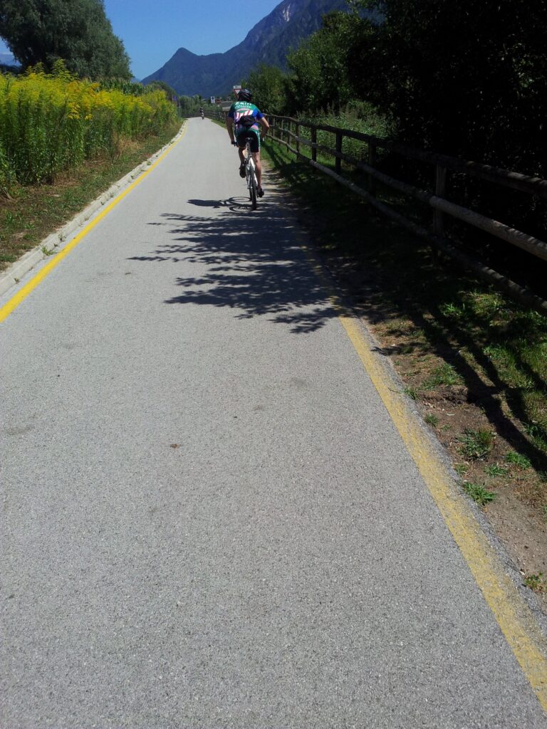
The surface is almost entirely good asphalt, with a few short stabilised sections. The standard width is 2.5 metres, enough for two-way passage. There are several access ramps along the way and numerous junctions with the SS47, handled with underpasses or controlled crossings. The tunnels are few, lit, and of modest length; it is worth carrying a rear light and at least a small headlight.
The main stages
Trento — Pergine Valsugana (about 17 km)
The first section crosses the hill above Trento, passes through the settlement of Roncogno and climbs to the pass towards Pergine. It is the most technical and demanding part, with a climb that is modest in absolute terms but felt by riders’ legs on the first day. For those starting from Bassano in the opposite direction, this section is a final gentle climb and is the most tiring stretch of the route.
Pergine — Levico (about 12 km)
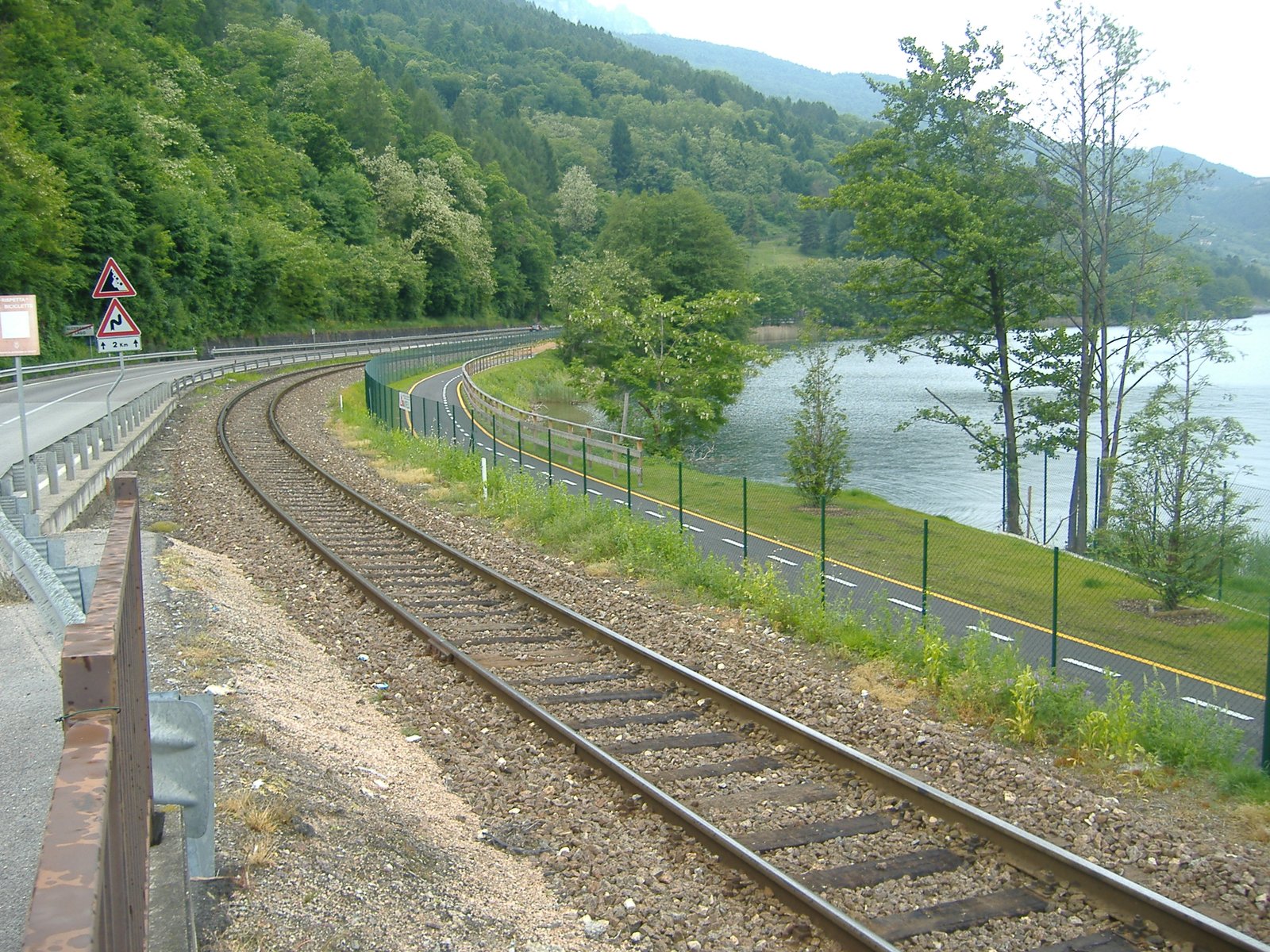
A flat and scenic section along the southern shore of Lake Caldonazzo, which the path skirts in places. It runs past the beaches of Calceranica and Caldonazzo, crosses the small settlement of Tenna on its mid-slope, and reaches Levico Terme. It is the ideal section for a day made half of riding and half of swimming.
Levico — Borgo Valsugana (about 18 km)
An open-valley section, flanked by the Brenta on the right and the slopes of the Lagorai to the south. The path runs through Roncegno Terme, Novaledo and Marter di Roncegno. Borgo Valsugana is an ideal end point for a day’s round trip with the train back, given that the station is central and the trains accept bicycles.
Borgo Valsugana — Grigno (about 20 km)
The most solitary part of the route. The valley narrows, the villages are smaller, the setting more wooded. The path passes through Strigno, Castel Ivano, Ospedaletto, Tezze Valsugana and Grigno. There are several refreshment points in small alpine huts and agriturismi along the way, but they are spread out rather than continuous.
Grigno — Bassano del Grappa (about 18 km)
The exit from Trentino. The path drops along the Canale del Brenta, inside the narrow gorge between the Grappa massif and the Asiago plateau. It is a spectacular section, sometimes damp, with a few longer tunnels. The arrival at Bassano del Grappa comes in by the celebrated Ponte Vecchio over the Brenta: for many, the true postcard image of the whole route.
How to ride it: options for tackling the route
In a day, with a train return. The most common option. You take the train to the highest point you want to reach, then ride down. Classic example: train from Bassano to Trento, cycle path from Trento to Bassano. You can also ride shorter segments: Trento-Borgo (47 km), Pergine-Bassano (63 km), or single sections of an hour to an hour and a half.
In two days. The most relaxed format. An overnight stop halfway along, generally in Levico or in Borgo Valsugana. It allows you to alternate riding and sightseeing, perhaps with a day on the lake or at the spa slotted in between. For less trained riders or for families with children, this is the format we would recommend.
In longer stages. The cycle path is also a leg of the European cycle network EuroVelo (the Munich-Venice link) and of Bicitalia. Riders travelling with luggage generally do two or three longer stages, stopping in Trento, Levico and Bassano.
Bicycle: rental or your own
Bike rental is widely available in the main towns of the valley: Pergine, Caldonazzo, Calceranica, Levico, Borgo Valsugana and several smaller points. Most rental outlets offer both standard bikes (daily rates of around 15-20 euro) and e-bikes (35-45 euro a day), with multi-day packages available. Some operators also offer a bike-shuttle service, that is the transfer of luggage between a start point and an end point, useful for linear rides. Drop-off at a different rental point from the pick-up (one-way) is generally possible by reservation, sometimes for a supplement.
For travellers with their own bike, transport on the Valsugana regional trains is allowed for a modest supplement; the trains have dedicated bike carriages. The portability of bikes rented from the official outlets of the Valsugana Bike scheme is generally included in the service. For current details on rates and availability it is worth checking the official Valsugana Turismo portal.
When to ride the Valsugana cycle path
The natural cycling season runs from mid-April to the end of October. The best months are May-June and September-October, with pleasant temperatures, fewer riders and still abundant daylight. July and August are ridable but the central hours of the day can be hot in the lower valley; it pays to set off early. From November to March the route remains ridable on the lower Veneto section, but some Trentino stretches can be icy in the morning and several rental outlets are closed.
Safety, signage, rest stops
The cycle path is signed with continuous kilometre markers and indications of points of interest. Along the route there are numerous rest areas equipped with tables, fountains and small panoramic terraces; some are fitted with bike racks. The bars and agriturismi that act as cyclist rest points carry a specific “Friends of Cycling” badge. The single emergency number (112) works of course across the whole route; for non-emergency mechanical assistance, some rental outlets offer a call-out service on request.
A helmet is not legally required for adults but is recommended, particularly in the tunnels and on the sections that cross built-up areas. For children it is required up to a certain age band under the Italian Highway Code; for the current rules we refer the reader to the Ministry of Infrastructure website.
- The Valsugana lakes — the cycle path runs close to both.
- Levico Terme — the best-equipped halfway stop on the route.
- Valsugana holidays — how to organise the full stay.
- Back to the home page